
LiDAR is revolutionizing aerospace, autonomous driving, military technology and even the latest iPhone’s camera. But there is one field that has yet to tap into the extraordinary potential of this groundbreaking tool: the Transmission and Distribution industry. At N Consulting Engineers, we believe in creating safer and more efficient utilities by answering the questions T&D engineers ask everyday: What’s in the field? Does it match what we designed? How do I know or verify the accuracy? Am I taking a shot in the dark and hoping for the best? The wrong answers to these questions could lead to major—and dangerous—problems for T&D companies and their customers.
Enter LiDAR: a modern and cost-effective solution to a problem utility companies have faced for decades. Once incorporated, LiDAR records exactly what is in the field without slow-moving ground survey teams limited by manned inspections. From the location of towers, ground elevation, roads, and even surrounding vegetation, LiDAR allows technicians to have unparalleled remote access to the status and condition of assets in the field in a cost efficient and timely fashion.
What is LiDAR?
LiDAR stands for Light Detection and Ranging. LiDAR is a remote sensing technology used to calculate the exact distance of an object. Topographical LiDAR data is collected by using rapidly firing light pulses in the form of a laser to calculate distance by measuring the time it takes for light to bounce back from the targeted object to the device.
LiDAR is an extremely effective technology when it comes to mapping large swaths of land quickly, and many industries have incorporated LiDAR into their operations. LiDAR is used to analyze coastlines, track the density of trees in forests, plan emergency response, and even map archeological surveys. LiDAR is a tried-and-true technology that has been put to the test across industries and generated game-changing results.
How can the transmission and distribution industry utilize LiDAR?
While the energy industry has not widely adopted LiDAR yet, this crucial tool is uniquely equipped to address one of the industry’s most pressing problems: assessing the health and reliability of the entirety of their asset pools.
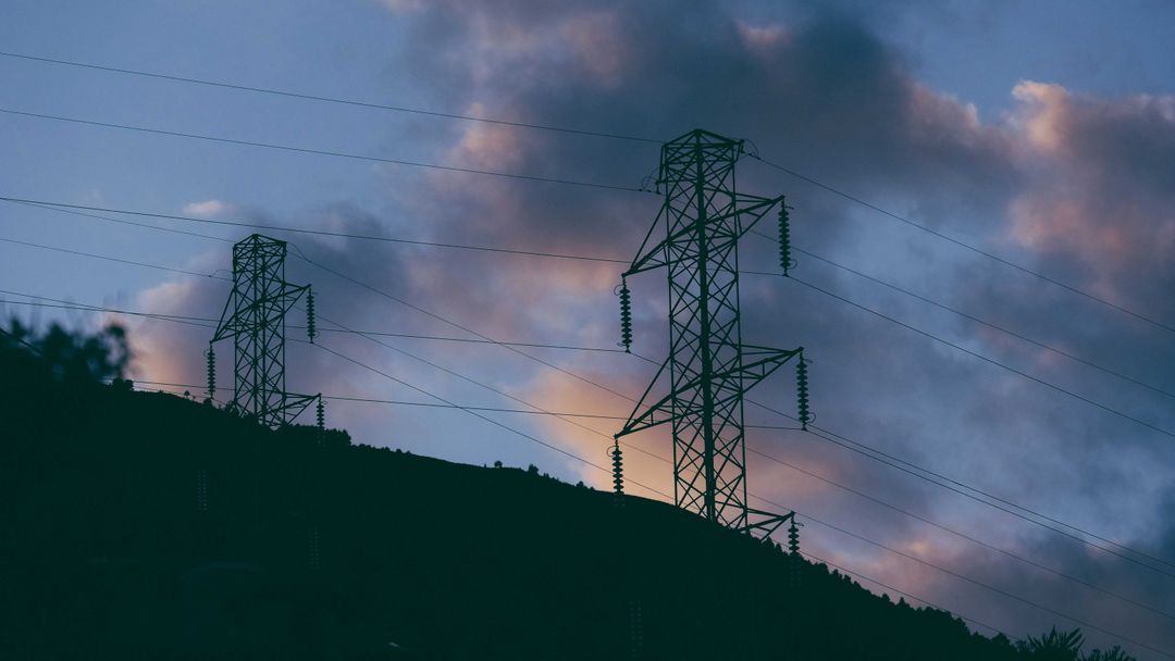
Transmission lines cover a lot of distance; deciding where to place them is historically done using expensive and time-consuming ground surveys. LiDAR allows utilities to map the desired area and determine how, where, and what to put up at locations along the alignment remotely. Today, LiDAR devices can be rigged to drones instead of more expensive options like helicopters or planes. Once the drones map the area and create a LiDAR point cloud, technicians can identify vegetation and other existing structures, analyze the terrain of the project, and most importantly, lead to a comprehensive understanding of the area that is being scouted for a project design.
As companies begin to utilize LiDAR, they can broaden their scope to include assessing the health of existing poles and towers. What used to require a survey crew accessing remote areas can now be done via LiDAR more often and in a fraction of the time. These checks mitigate risk and increase reliability. Engineers and Designers can now confirm whether anything is out of place or out of compliance more regularly, which in turn can avoid disaster or fines. Engineers and designers can look at clearances to ground and other transmission or distribution lines, they can analyze tensions in the conductor to evaluate the sag, and analyze the structures to see if they are overloaded.
LiDAR can be used to classify ground features, roads, crossing lines and even pathways. Utilities can use LiDAR data to create a 3D map of their lines and all the surrounding features around them for unprecedented access to information that can increase the details of engineering and maintaining a healthy and reliable system. LiDAR is the key to utilities acting quickly, effectively, and robustly when it comes to the health of their assets and the safety of their customers.
Incoroprating LiDAR into your company
EKN’s LiDAR analysis programs are providing critical data intelligence to power utility clients. With extensive background and expertise in LiDAR, EKN has the expertise needed to create invaluable LIDAR models that track and verify the condition of thousands of assets and give our clients sweeping, unparalleled access to what is in the field. For more information, drop us a line and we can show you what LiDAR can do for you.